Innovative LASER technology
Where precision meets innovation!
Discover every dimension!
We use the latest technology in 3D scanning and engineering to ensure top-quality results.
About us
ScanSpace is an company specializing in 3D scanning, 3D modeling, and engineering technologies. Our mission is to enable precise and efficient capturing and analysis of spaces and objects, providing high-quality services to our clients.
Our mission:
At ScanSpace, we believe that precision is the key to success. Our mission is to deliver the highest level of services in the field of 3D scanning and engineering, allowing our clients to make informed decisions based on accurate and detailed data.
Our services include:
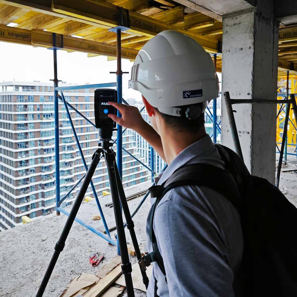
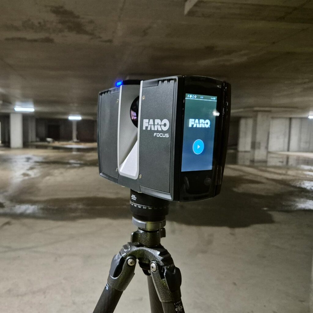
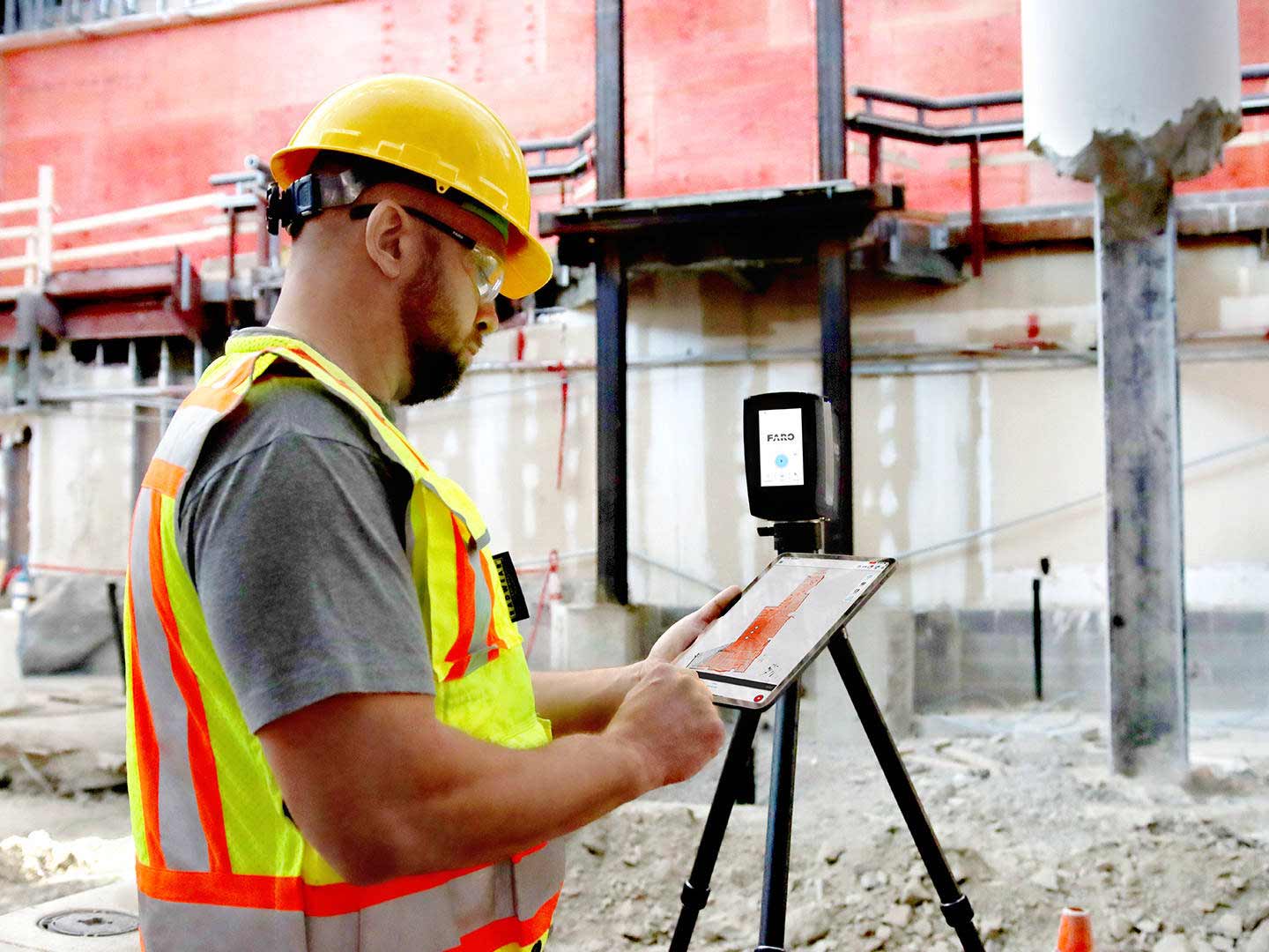
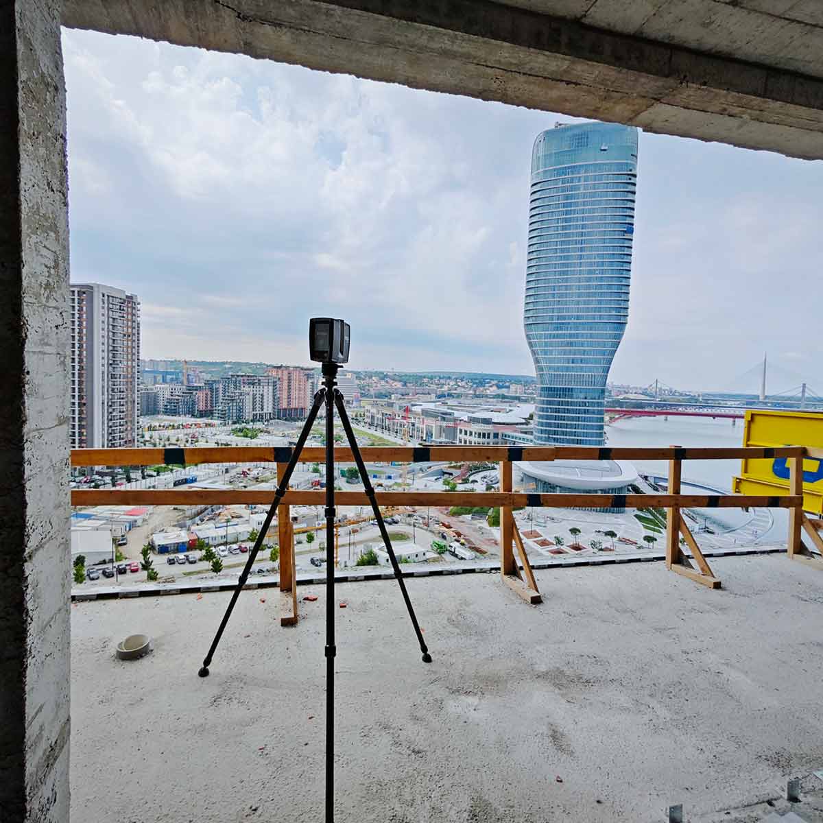
3D LASER SCANNER
Faro Focus Premium
We use innovative technology that enables precise scanning of both indoor and outdoor objects, covering distances up to 70 meters with high accuracy. Our equipment offers high-precision scanning tailored to the specifics of the project and features a built-in 360° camera for creating detailed photo documentation. With the Faro laser, you’ll never need to return to the site due to missed measurements.
Precision and Accuracy
Our services
From 3D scanning and modeling to engineering consultations and design in the process industry. We guarantee a high level of precision and accuracy in all our services, using licensed software such as Autodesk and Faro.
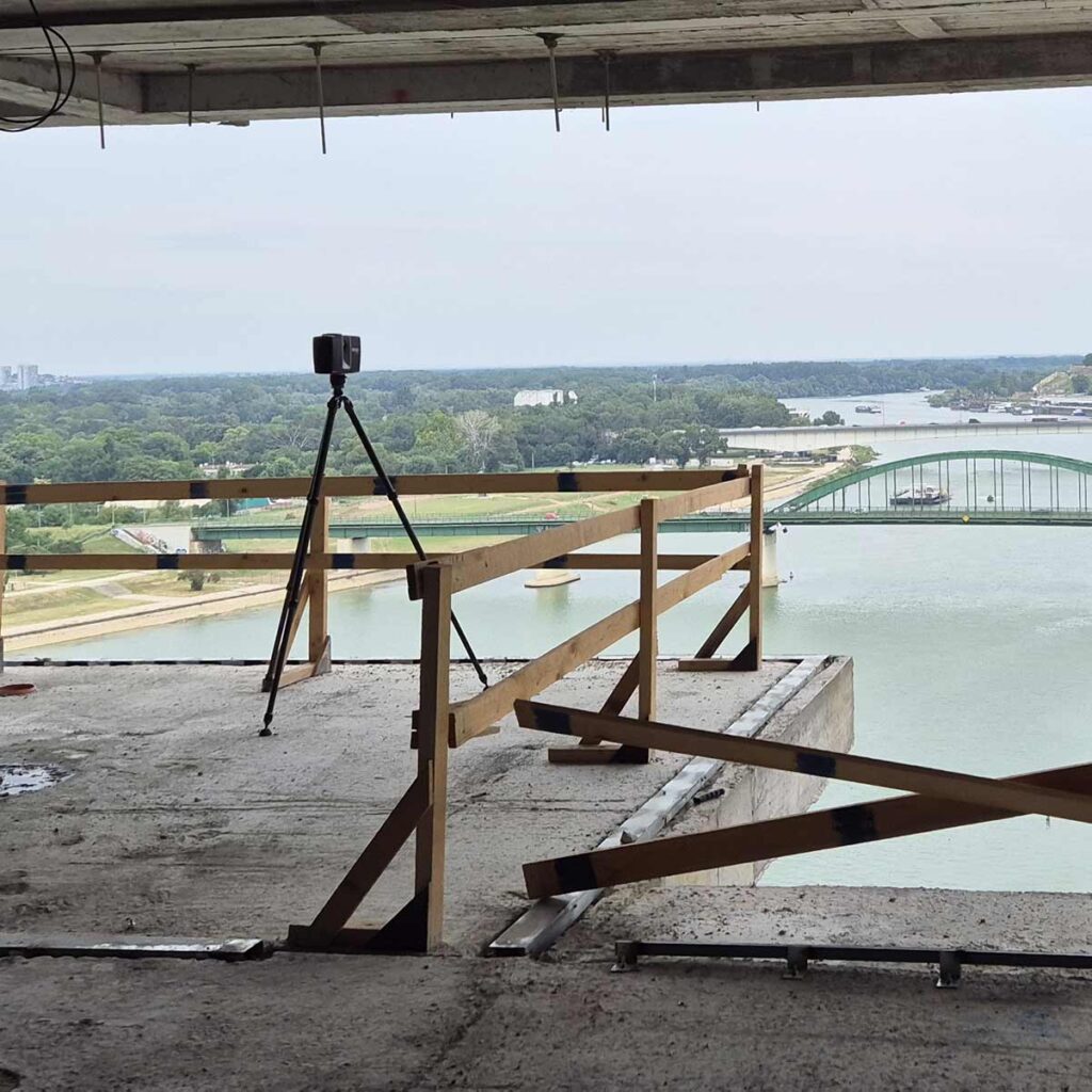
Laser Scanning
Objects
Terrain
Equipment
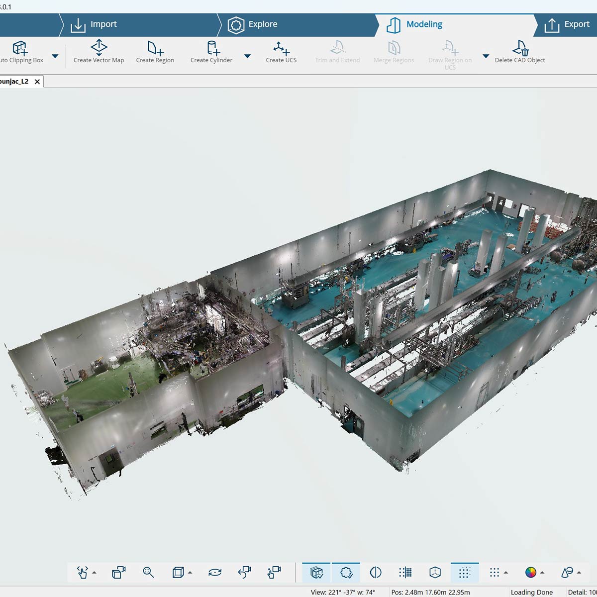
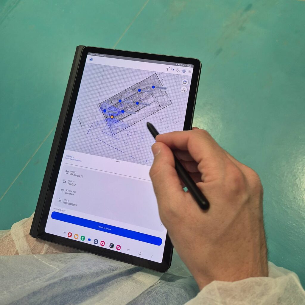
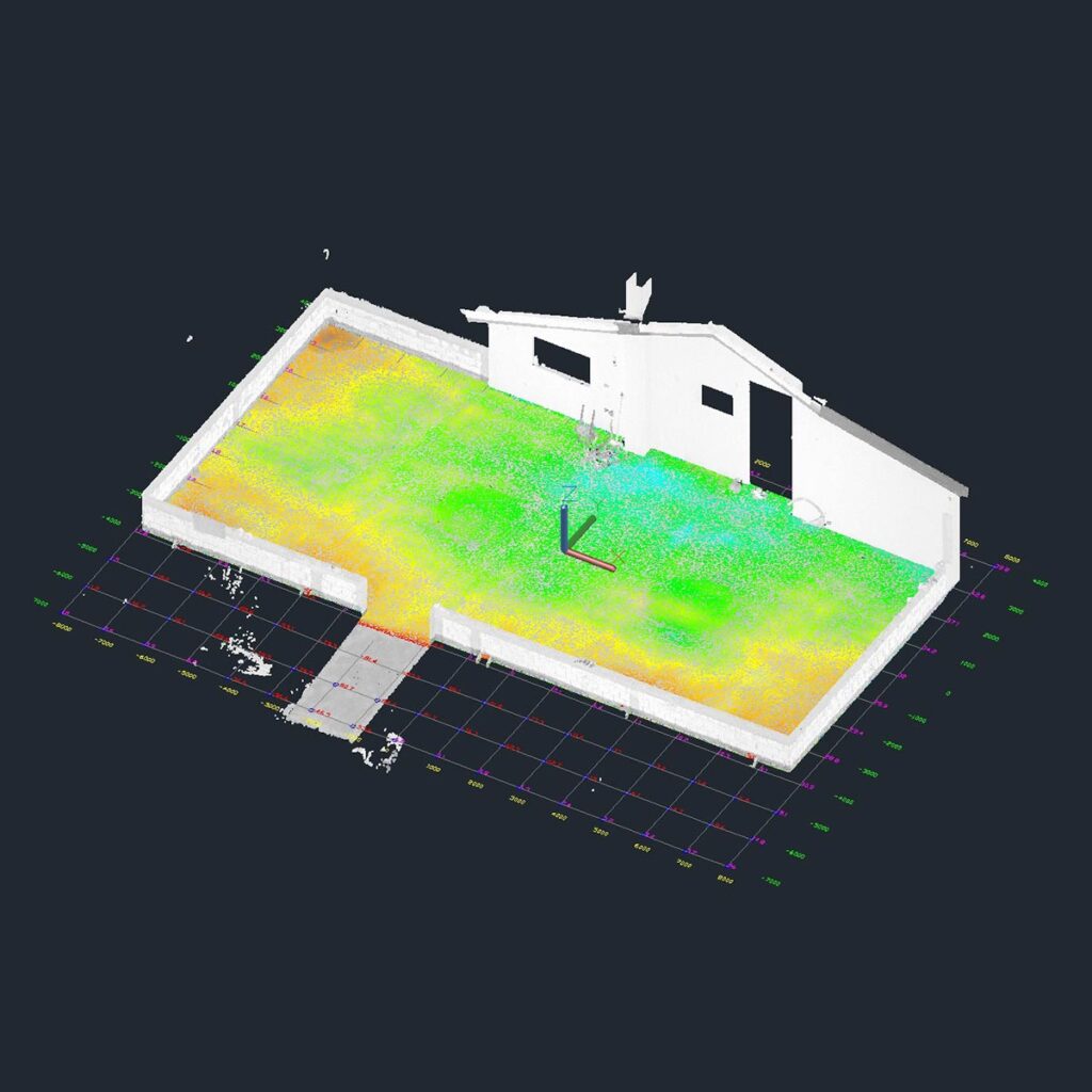
Processing of scanned data
Point cloud generation
Creation of editable formats
Creation of 360° views in HDR
Engineering
3D modeling
Surface analysis
Design
Application
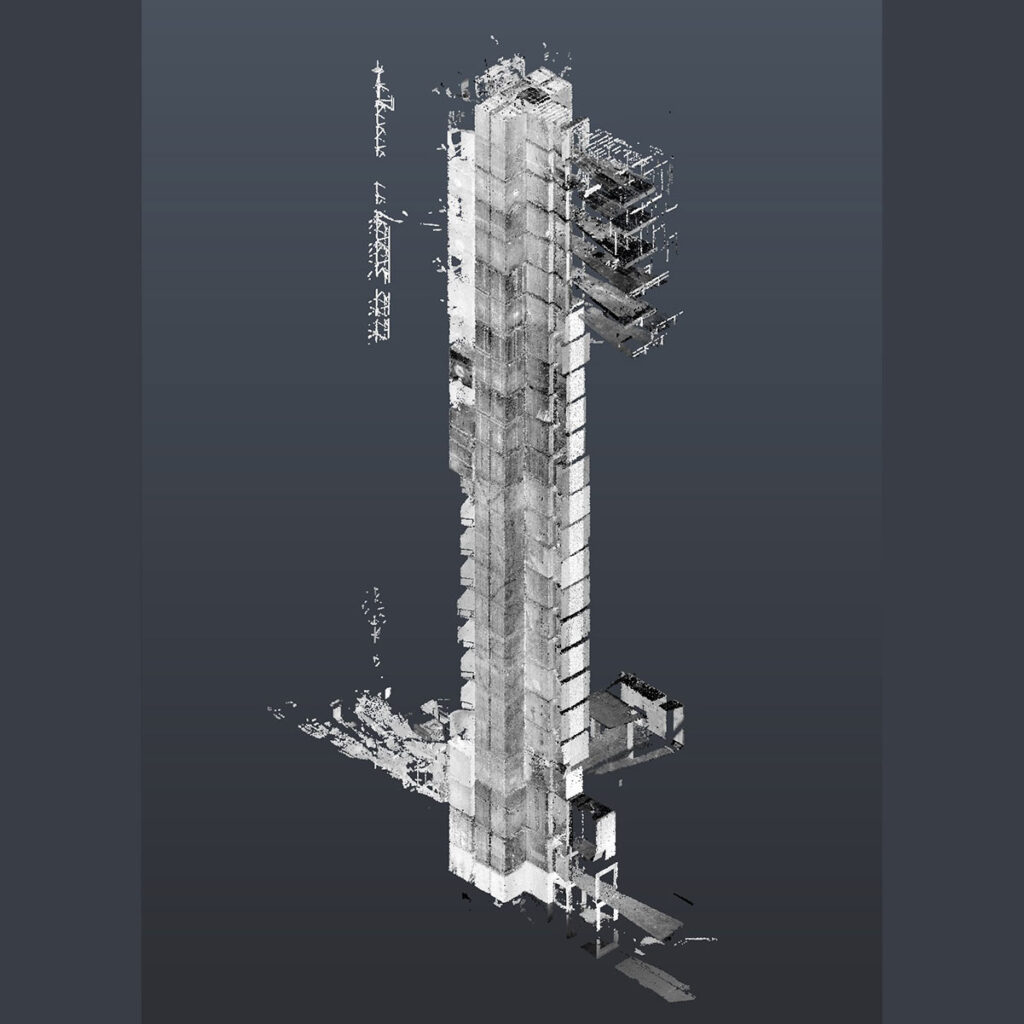
3D laser scanners, like the FARO Focus Premium, are powerful tools used across many industries due to their ability to capture highly accurate and detailed 3D representations of objects and environments
Architecture
Exterior and interior
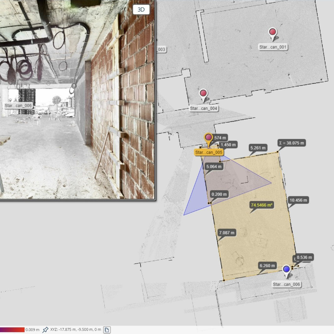
We offer scanning services for entire buildings to create missing documentation that reflects the actual state, such as floor plans, facade plans, or elevation plans. Based on this data, we can plan your architectural model or assemblies, such as facade panels, insulation, or solar systems. We efficiently create 3D models that represent the actual state, including ground surfaces, walls, doors and windows, columns, beams and pillars, roofs, or even pipe installations in commercial and industrial buildings. Our service allows you to start the BIM process with minimal effort, providing greater security and transparency.
Construction
Earthworks
We offer fast and accurate volume calculations for scanned embankments or excavations within construction or civil engineering projects. We create precise terrain models and topographic maps for your civil engineering projects.
Interior Finishing
We provide services for measuring actual deformations in complex situations, such as roof structures, elevator shafts, or interiors of historical buildings. We bypass outdated documentation to help you plan drywall, carpentry, or staircases in building repurposing projects. We validate your designs for prefabricated construction modules, ensuring they fit perfectly into existing conditions without the need for additional work.
Construction Systems
Rely on our unmatched solution for as-built documentation for facilities and MEP systems, including pipelines or HVAC systems. We use system element inventory documentation to create a bill of materials, and we also perform high-precision measurements for connection points and clearances for SKID assemblies or other modular exchanges.
Structures
We offer accurate and complete field documentation for construction structures made of wood, steel, or concrete, including roofs, beam systems, columns, and pillars. We help you extract as-built models for precise structural calculations and analyses.
Industry
CAD data extraction
We offer surface extraction and export services into common CAD exchange formats (DXF, STEP, IGES), allowing you to convert point clouds into CAD models. These models can be used in your familiar CAD systems as an accurate representation of the actual site conditions.
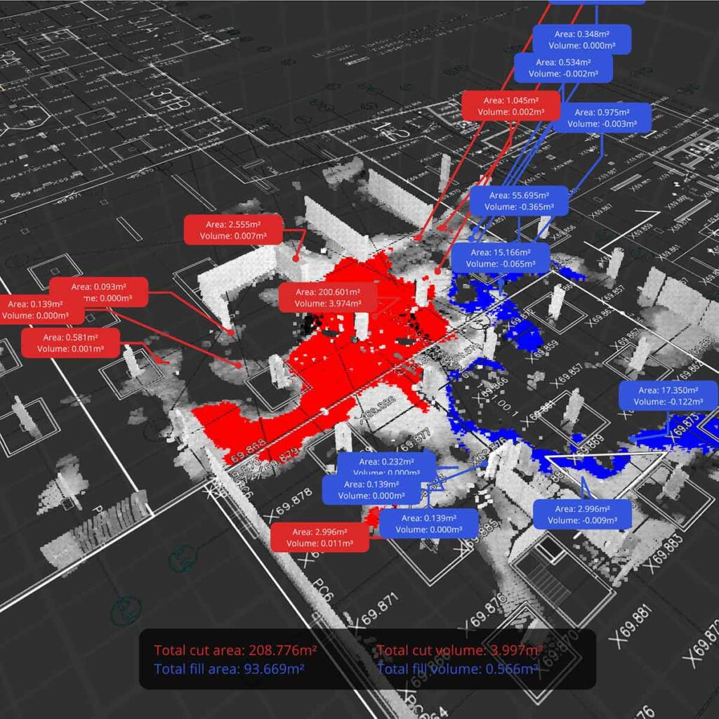
Design validation
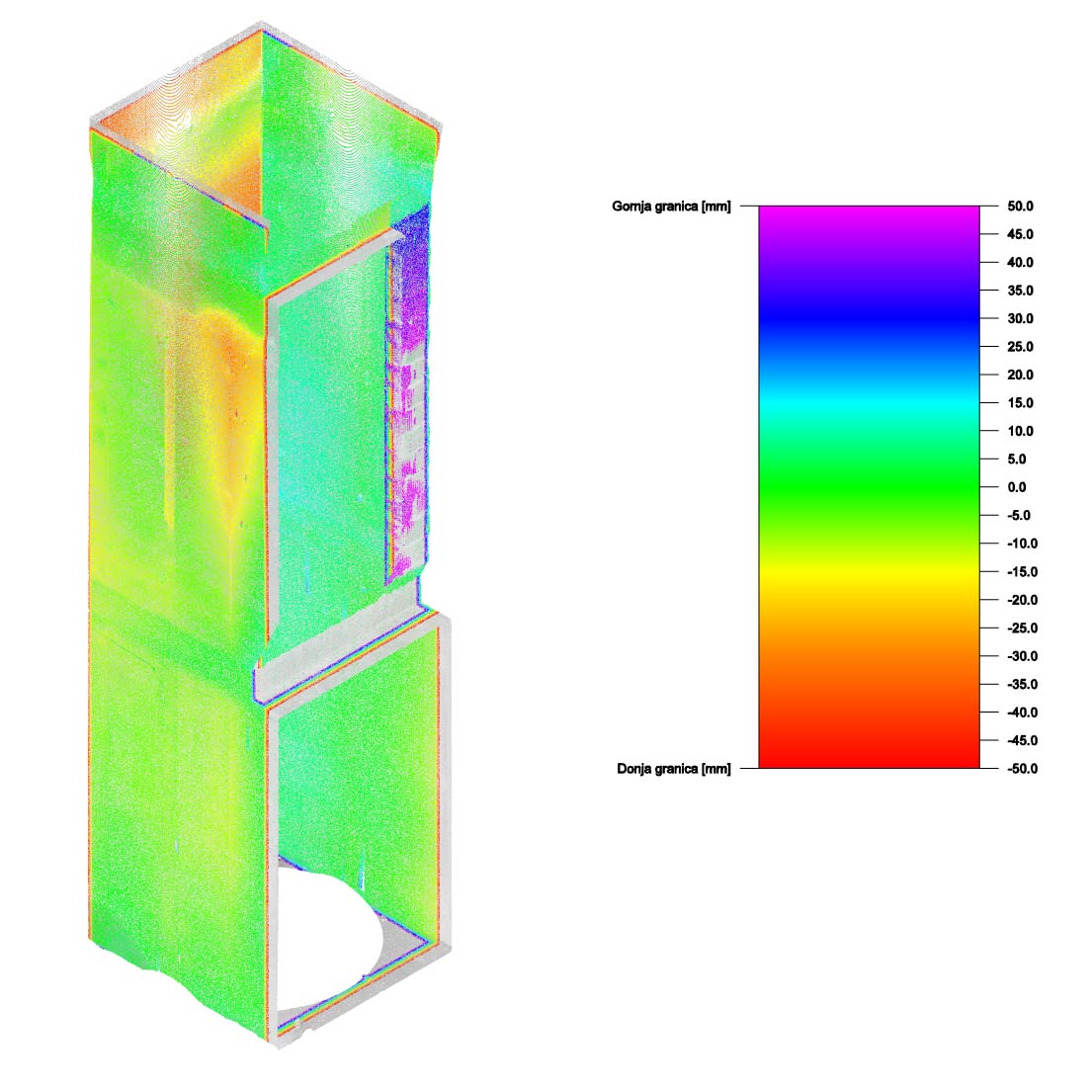
We provide the capability to virtually overlay your design with the actual site conditions to verify if it meets clearance requirements or if design adjustments are needed to avoid collisions. Our tools for automatic surface deviation analysis and clash/clearance detection significantly reduce the time required for these processes.
Precision measurement
We offer precision measurement services with millimeter-level accuracy. We measure distances, areas, volumes, clearances, and high-precision connection points to ensure that your designs achieve the highest level of quality.
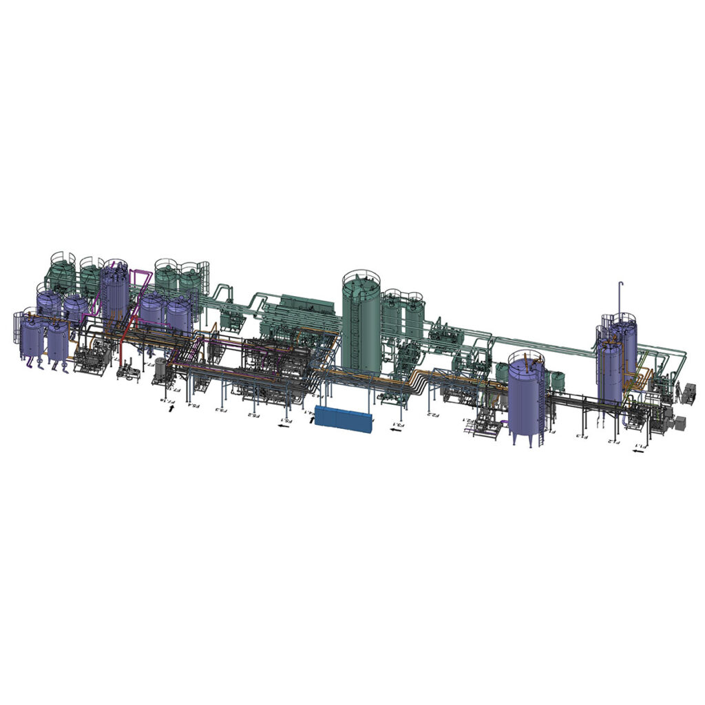
3D Modeling of process systems
By applying laser technology and point cloud data, we have enhanced our key role in engineering, paving the way for a much more efficient and accurate realization of 3D models in the industry.